Welcome to djgaston.com

Tag: Arkansas history

Herman Davis: The Big Lake Duck Hunter Who Became One of Arkansas’s Greatest WWI Heroes

If you drive Highway 18 through Manila, Arkansas, you’ll pass a tall granite spire with a life-sized soldier standing in front of it. Plenty of people never pull over. The man buried behind that statue was a 5-foot-3 duck hunter from Big Lake who came home from France with top medals from two countries, and his own neighbors didn’t know it.
Quick answer Herman Davis (1888–1923) was a Big Lake hunting guide and market hunter from Manila in Mississippi County, Arkansas. Drafted in March 1918, he served as a runner and scout with Company I, 113th Infantry, 29th Division. On October 10, 1918, at Molleville Farm north of Verdun, he reached a German machine gun nest ahead of his platoon and killed its four gunners, which earned him the Distinguished Service Cross. France gave him the Croix de Guerre with palm, a gilt star for it and the Médaille Militaire. He was later named on General Pershing’s list of 100 outstanding World War I heroes, usually described as fourth on it. He died of tuberculosis at a veterans’ hospital in Memphis on January 5, 1923, at 35. His grave and 1925 monument are now Herman Davis State Park, a site of about one acre at Ark. 18B and Baltimore Street in Manila.
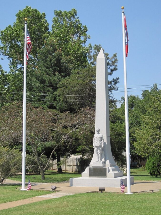
Herman Davis Memorial in Manila, Arkansas: a white granite obelisk with a life-sized soldier statue in front, flanked by U.S. and Arkansas flags on a grassy lot
The Herman Davis Memorial at Herman Davis State Park in Manila, Arkansas. Photo: Thomas R. Machnitzki, 2011, CC BY 3.0. Wikimedia Commons

A boy from Big Lake

Herman Davis was born on January 3, 1888, at Big Lake Island, the settlement that later became Manila, according to the Encyclopedia of Arkansas. (The 1995 National Register nomination for his memorial gives January 2 in one place, but the monument itself says January 3.) His parents, Jeff and Mary Ann Davis, ran a little country store and got by on hunting, fishing and some farming.

His father died while Herman was in the fourth grade, and Herman quit school to help support the family. While still young, probably in his teens, he was guiding sportsmen who came over from Blytheville.

Big Lake was created by the New Madrid earthquakes of 1811–1812, which turned a free-flowing river into lake and swamp. The U.S. Fish and Wildlife Service says winter waterfowl numbers there can still top 200,000 birds.

The market-hunting era

After the Civil War, railroads came into northeast Arkansas for timber. The Encyclopedia of Arkansas says the same trains carried the market hunters’ kill north: iced barrels of venison, ducks, fish and even frogs for restaurants in other states. Wealthy sportsmen, mostly from St. Louis, leased up hunting land, and the fights with locals from the mid-1870s to 1915 are remembered as the Big Lake Wars.

The Encyclopedia of Arkansas and the National Register nomination both say he and his cousin James Davis reportedly killed as many as 400 ducks a day and shipped them to northern markets, where they got about a dollar a duck. That’s a reported figure, not a kept count.

The laws were catching up fast. The Lacey Act of 1900 made it a federal offense to ship illegally taken game across state lines. The Weeks-McLean Act of 1913 banned spring shooting of migratory birds, though courts soon ruled it unconstitutional. After a 1916 treaty with Great Britain (for Canada), Congress passed the Migratory Bird Treaty Act in 1918. That law made it a crime to “pursue, hunt, take, capture, kill” or “sell” a migratory bird, and Ducks Unlimited notes that most market hunting died out quickly after it.

Closer to home, President Woodrow Wilson made Big Lake a federal bird reserve on August 2, 1915, the same year Arkansas created its Game and Fish Commission. The life Herman grew up in was ending about the time the Army came for him.

Too small, then drafted

The Encyclopedia of Arkansas says he was first rejected for military service because of his 5-foot-3 frame. One later account says instead that he claimed an exemption for his size and age, so the exact story isn’t settled. Either way, he was drafted and inducted at Blytheville on March 4, 1918. (The bronze plaque on his monument says he “enlisted” March 14, 1918, a small conflict in the record.) He was 30 years old.

He had been married, and he had a young son. The encyclopedia says his mother looked after the boy while he was away.

He trained at Camp Pike near Little Rock, about 90 days by the National Register’s count, and sailed for France on June 15, 1918, with Company I of the 113th Infantry. The 113th was part of the 29th “Blue and Gray” Division, built from National Guard units from New Jersey, Maryland, Virginia, Delaware and the District of Columbia. The division’s 1921 history says its largest batches of draftees, men from all over the country, arrived about three weeks before it sailed, which is probably how an Arkansas draftee ended up in a New Jersey regiment.

According to the National Register nomination, Davis served in the Center Sector in Haute-Alsace from late July to late September 1918, then went into the Meuse-Argonne offensive in October.

Molleville Farm: what’s documented

On October 8, 1918, the 29th Division attacked the heights east of the Meuse River, north of Verdun. The American Battle Monuments Commission’s guide describes days of hard fighting through the woods and ravines around Molleville Farm. Historian Jimmy Price calls the farm “an awful death trap” that wasn’t finally taken until mid-October.

Herman Davis’s Distinguished Service Cross citation, printed in War Department General Orders No. 46 (1919) and in the division’s own history, is the most solid account of what he did. It reads in part:

“On duty as a company runner, Private Davis was accompanying the left assault platoon of his company during the advance through the woods, when it was fired on by an enemy machine gun. As soon as the gun opened fire the members of the platoon scattered and attempted to flank the gun, but Private Davis pushed on ahead, being the first to reach the nest, attacked it single handed, and killed the four enemy gunners. His gallant act enabled his platoon to continue the advance.”

A version that ran in newspapers in April 1919 adds that he “captured the gun.” The 29th Division’s history lists him among the men decorated in its General Orders No. 14 of April 20, 1919.

The National Register nomination fills in the usual telling: Davis crawled forward on his own to about 50 yards from the gun, which sat on a hilltop, and picked off the four Germans one at a time. It also says an officer from another company saw the attack and recommended him for recognition.

Even this action has more than one version. Arkansas Road Stories notes that Davis rarely spoke of it, and that a friend’s account of what he said (shooting the crew one at a time from about 50 yards) doesn’t fully match the citation. Every account agrees he took out that gun crew alone.
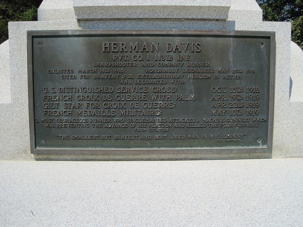
Bronze plaque on the Herman Davis Memorial listing his unit, his Distinguished Service Cross, Croix de Guerre with palm, gilt star and Medaille Militaire with dates
The bronze plaque on the monument lists his medals and quotes his captain: “The smallest but bravest and best liked man in my company.” Photo: Thomas R. Machnitzki, 2011, CC BY 3.0. Wikimedia Commons

The other stories: legend or fact?

Several more stories get told about Davis, and they’re much harder to pin down than the citation.

  • The dugout. The National Register nomination says that after getting separated from his comrades, Davis came on a German dugout and shot the men as they came out, “killing 11 in all.” The Encyclopedia of Arkansas also gives eleven. Another account puts the number at fifteen.
  • Another machine gun nest. The Encyclopedia of Arkansas says he was credited with killing fifteen gunners in a machine gun nest in a separate fight.
  • “Just good shootin’ distance.” In the best-known story, Davis and other soldiers watched Germans setting up a machine gun about 1,000 yards away. When the others said the enemy was out of range, Davis supposedly said, “Why, that’s just good shootin’ distance,” and shot five of them. The encyclopedia says he “reportedly” said it.
  • The total. An Arkansas State Archives exhibit says he was credited with killing 24 German soldiers.

The nomination says Davis himself told two of these stories. Arkansas Road Stories argues that many of the details only came out after his death, when there was nobody left to contradict them. None of them are in his citation. The Molleville Farm machine gun is documented. The dugout, the 1,000-yard shots and the totals are stories handed down, and the numbers don’t agree.

His medals

The plaque on his monument, transcribed in the National Register nomination, lists four decorations:

  • U.S. Distinguished Service Cross, for October 10, 1918. Congress authorized it by an act of July 9, 1918, and it ranks just below the Medal of Honor as the Army’s second-highest award for extraordinary heroism.
  • French Croix de Guerre with Palm, dated April 19, 1919. On the Croix de Guerre, a bronze palm meant the soldier was cited at the army level.
  • Gilt Star for the Croix de Guerre, dated April 23, 1919. A gilt star meant a citation at the corps level.
  • French Médaille Militaire, dated May 10, 1919. It was given mainly to enlisted men and noncommissioned officers, and to a few top generals.

The Encyclopedia of Arkansas, the Arkansas State Archives and the 29th Infantry Division all list the same four. He was honorably discharged on May 29, 1919.

Pershing’s list and the “fourth greatest hero”

Almost every write-up about Davis says General John J. Pershing ranked him fourth among the 100 greatest American heroes of the war. The Encyclopedia of Arkansas, the National Register nomination and a marker at the Old State House in Little Rock all put him fourth. The 29th Infantry Division calls it “Pershing’s 100, a list of one hundred individual acts of extraordinary heroism.”

Here’s what can actually be confirmed. In April 1919, newspapers ran a feature saying it was hard to pick out of thousands of brave acts “a few that stood out above all others,” and that “General Pershing’s staff undertook the task.” Davis was one of the Distinguished Service Cross stories printed. In one surviving copy, in the Altus Weekly News of Oklahoma, he isn’t fourth; he’s one of 13 stories on the page.

A researcher who later got a copy of the list from the National Archives reported (on Arkansas Road Stories) that it was titled something like “100 outstanding stories of heroism in the Great War,” that it didn’t seem to be ranked, and that the first sixty or so names were alphabetical. If that’s right, “fourth on the list” is true, but “fourth greatest hero” probably reads more into it than Pershing meant. Arkansas State Parks words it more carefully: Davis “was on General John J. Pershing’s list of WWI’s 100 great heroic stories.” The original list wasn’t available to check, so the “fourth greatest” ranking is best treated as an Arkansas tradition, not a settled fact.

The medals in the tackle box

Back home, Davis went to work at the Big Lake Hunting Club and went right back to hunting and fishing. By every account he didn’t talk about the war. The nomination says his neighbors knew nothing of his medals until the Pershing list came out. When friends asked to see them, he took them out of his old fishing tackle box, “where they rested amid his fishing lures.”

The Encyclopedia of Arkansas, the nomination and the Arkansas State Archives all tell it, but all were written long after the fact, so treat it as a well-loved local tradition, not a firsthand record. The nomination adds that he wore the medals in public only once, at Christmas, because his mother asked him to. His American Legion friends in the Dud Cason Post in Blytheville liked to show him off, but he hated it. After one time on a stage, “his friends never again subjected him to such an unpleasant experience.”

Gas, tuberculosis and a quiet death

As a scout who went out ahead of his company, the encyclopedia says, Davis ran into poison gas many times. The encyclopedia, the National Register nomination and the Arkansas State Archives all say that exposure led to his tuberculosis. That was the belief at the time, and it can’t really be proven now. One account says the Army had no record of him being gassed, which kept him from getting compensation.

By the fall of 1922 he had advanced pulmonary tuberculosis and couldn’t work. The nomination says he was admitted to U.S. Hospital No. 88, the veterans’ hospital in Memphis, on December 9, 1922, and members of the Blytheville Legion post helped get him there. He died there on January 5, 1923, during an operation, two days after his 35th birthday.

He was buried on January 8 in a small church cemetery in Manila. In August 1923 the Osceola Times ran the headline “Arkansas’ Greatest Hero Lies in Unmarked Grave” and reported that he “now is buried in an unmarked grave near that town.” The nomination says the grave was marked only by a small wooden cross and a pair of “faded, torn American flags.”

The recognition came mostly after he was gone. Sen. T. H. Caraway complained on the U.S. Senate floor that Davis had never gotten any compensation from the government and had been turned down for a caretaker job at the Big Lake refuge because he couldn’t meet Civil Service requirements. The Arkansas legislature passed a resolution, dated January 23, 1923 on the Little Rock marker, naming him “Arkansas’s most distinguished son in action in World War I.”

The pennies and the 1925 monument

In 1923 the American Legion post in Marianna started the Herman Davis Memorial Association. The state Legion, other posts, and the Lions, Rotary, Kiwanis and Elks clubs joined in. Pershing wrote them a letter of support, and Gov. Thomas McRae declared a “Herman Davis Week” in September 1923.

The Encyclopedia of Arkansas says a “pennies drive” by Arkansas schoolchildren helped pay for the monument. The National Register nomination gives a more mixed picture. A May 1925 Legion newspaper admitted that “the statewide campaign has largely been a failure, except in this [Mississippi] county, where the bulk of the money was raised.” Plans for a university scholarship and a second memorial in Little Rock were dropped. So the kids’ pennies were real help, but most of the money seems to have come from home.

The city of Manila gave land at Baltimore Street and Highway 18. The 25-foot granite shaft came from the Milne, Gray & Varnum quarries in Rutland, Vermont, and was put up by contractor John C. McHaney Jr. A marble statue was ordered from carvers in Carrara, Italy, and ran so late that the nomination says it’s unclear whether it was in place for the dedication. The monument was dedicated on Memorial Day 1925, and Davis’s body was moved from the churchyard and reburied at the back of it.

The back of the shaft reads: “Erected by the people of Mississippi County in grateful memory of their hero Herman Davis … He gave his life upon the altar of his country.”

In 1967 vandals destroyed the original statue. The nomination says it was replaced with an exact copy in Barre granite; the obelisk is unchanged.
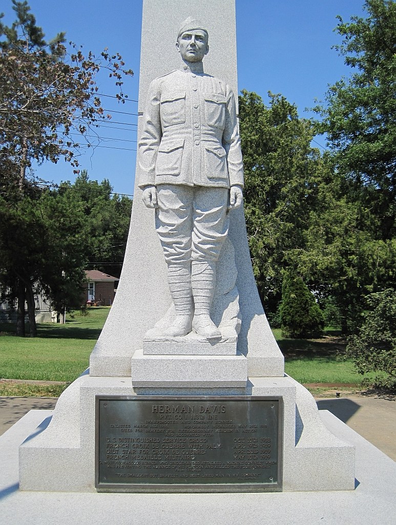
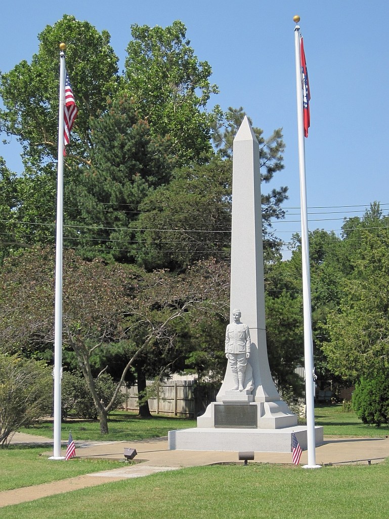
Life-sized white granite statue of Herman Davis in World War I uniform standing on a base in front of the obelisk, with a bronze plaque below
The statue of Davis in uniform. The original was destroyed by vandals in 1967 and replaced with a granite copy. Photo: Thomas R. Machnitzki, 2011, CC BY 3.0. Wikimedia Commons

Herman Davis State Park today

The Arkansas General Assembly made the memorial a state park in 1953. It was listed on the National Register of Historic Places on April 7, 1995. The nomination calls it the only surviving historic site tied to Davis.

The National Register describes a park of “less than one acre,” and the Encyclopedia of Arkansas calls it one acre of land around the monument and gravesite. What’s there is the obelisk and statue, Davis’s grave behind it, two flagpoles flying the U.S. and Arkansas flags, open lawn and a concrete walk. Arkansas State Parks says the site “preserves Davis’ final resting place and does not include park facilities,” and that it’s open all year.

In March 2018, on the 100th anniversary of his induction, soldiers from the Virginia National Guard’s 29th Infantry Division joined American Legion Post 197 and the Manila Depot Museum to plant a willow oak in his memory. In November 2021 he was inducted into the Arkansas Military Veterans’ Hall of Fame. A great-niece accepted the award.

In Little Rock, in 1954 the old iron fountain at the Old State House, once part of Arkansas’s exhibit at the 1876 Centennial Exposition in Philadelphia, was renamed the Herman Davis Memorial Fountain, and a marker nearby tells his story.

If you want to visit

  • Where: Arkansas State Parks gives the location as the corner of Ark. 18B and Baltimore Street, Manila, AR 72442. Older sources say Highway 18. Manila is in western Mississippi County, east of Jonesboro.
  • When: Open all year. The state says the site has no park facilities, so plan on no restrooms.
  • What to expect: A monument, a grave and a lawn. Read the plaque on the front and the inscription on the back, and remember it’s a grave.
  • Nearby: Big Lake National Wildlife Refuge, the water Herman hunted, is about 2 miles east of town. It covers 11,038 acres, and waterfowl peak in January and February. Check the refuge’s hunting dates and rules before you go.
  • Questions: The state parks page lists hermandavis@arkansas.com as the contact.

Manila is in the Delta, not the Ozarks, but Herman’s story belongs with the rest of Arkansas’s back-country history. For more like it, see Arkansas and Ozarks History Worth Knowing, Ozark Saltpeter Caves and Ozark Springhouses.

Related on djgaston.com

Sources

  • Encyclopedia of Arkansas, “Herman Davis (1888–1923),” by Donna Brewer Jackson: encyclopediaofarkansas.net
  • National Register of Historic Places Registration Form, “Herman Davis Memorial,” Manila, Mississippi County (Mark Christ, Arkansas Historic Preservation Program, 1995): arkansasheritage.com
  • Arkansas State Parks, “Herman Davis State Park”: arkansasstateparks.com
  • Hall of Valor (Military Times), Herman Davis, Distinguished Service Cross citation, War Department General Orders No. 46 (1919): valor.militarytimes.com
  • John A. Cutchins and George Scott Stewart Jr., History of the Twenty-ninth Division, “Blue and Gray,” 1917–1919 (Philadelphia, 1921): archive.org
  • American Battle Monuments Commission, American Armies and Battlefields in Europe, Meuse-Argonne chapter: abmc.gov
  • Jimmy Price, “From Molleville Farm to Memorial Day,” Over There: Blogging the AEF & WWI (2015): overthere1.blogspot.com
  • The Altus Weekly News (Altus, Okla.), April 10, 1919, p. 3, via The Gateway to Oklahoma History: gateway.okhistory.org
  • Arkansas Road Stories, “Arkies at War: Herman Davis of Manila” (with reader correspondence on the Pershing list): arkansasroadstories.com
  • Arkansas State Archives, “Arkansas in the Great War Part III: In the Trenches,” Google Arts & Culture: artsandculture.google.com
  • Virginia National Guard, “29th Soldiers participate in ceremony honoring WWI veteran” (2018): va.ng.mil
  • Northeast Arkansas Town Courier, “Manila WWI hero inducted in the Arkansas Veterans Hall of Fame” (2021): neatowncourier.com
  • Historical Marker Database, “In Memory of Herman Davis” (Old State House, Little Rock): hmdb.org
  • Encyclopedia of Arkansas, “Big Lake Wars”: encyclopediaofarkansas.net
  • Encyclopedia of Arkansas, “Big Lake National Wildlife Refuge” and “State Parks Division”: Big Lake NWR; State Parks Division
  • U.S. Fish and Wildlife Service, “Big Lake National Wildlife Refuge” and “Migratory Bird Treaty Act of 1918”: fws.gov/refuge/big-lake; fws.gov/law
  • Audubon, “The History and Evolution of the Migratory Bird Treaty Act” (2015): audubon.org
  • Ducks Unlimited, “The Birth of Wildlife Conservation”: ducks.org
  • Wikipedia, “Big Lake National Wildlife Refuge” (distance from Manila): wikipedia.org
  • Wikipedia, “Croix de guerre 1914–1918 (France),” “Médaille militaire” and “Distinguished Service Cross (United States)” (award background only): Croix de guerre; Médaille militaire; DSC

Follow Danny on X: @djgaston19
Ozark Saltpeter Caves: How Cave Dirt Became Civil War Gunpowder (and the Story of Bean Cave)

Long before anybody sold tickets to Ozark caves, men were in them with shovels and mattocks, hauling out the dirt. That dirt held saltpeter, the main ingredient in black powder. During the Civil War, a little bluff cave on the White River in Marion County, Arkansas, called Bean Cave, was worth sending cavalry to wreck.

Quick answer Saltpeter is potassium nitrate, and it made up about 75% of the black powder 19th-century guns used. Dry Ozark caves can have floors rich in nitrate salts built up from bat guano and other organic matter. Workers dug that dirt, soaked it in wooden hoppers, mixed the liquid with lye from wood ashes, and boiled it in iron kettles until saltpeter crystals formed. Confederates worked caves in Marion, Newton and other north Arkansas counties, and Union cavalry raided them again and again. Today most of these caves are closed or on private land, and many shelter bats hit by white-nose syndrome. In Arkansas it’s against the law to dig in or disturb an archeological site in a cave without the owner’s permission.
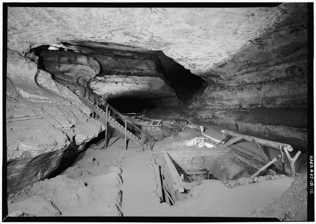
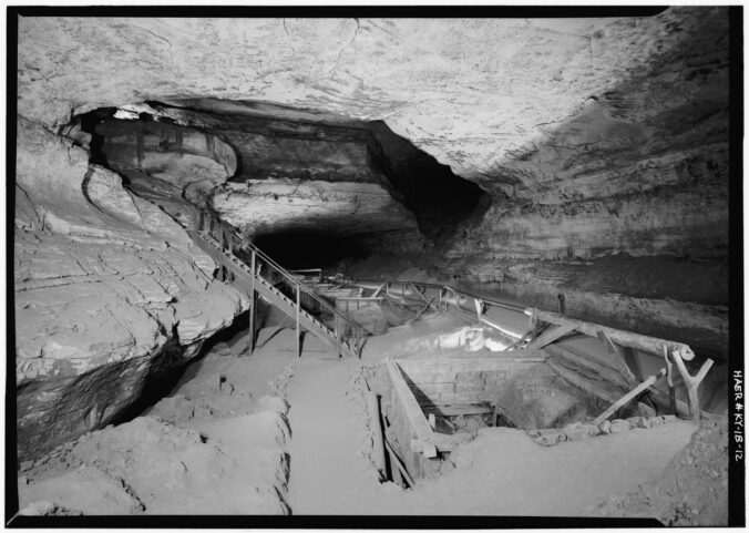
Wooden saltpeter leaching vats and a stairway in a large cave passage at Mammoth Cave
War of 1812-era leaching vats in Booth’s Amphitheater, Mammoth Cave, Kentucky, which the Historic American Engineering Record calls the most complete known example of cave saltpeter equipment. Photo: Jet Lowe, HAER KY-18, Library of Congress, public domain. Wikimedia Commons

What saltpeter is and why it mattered

Black powder is saltpeter, charcoal and sulfur. In a 1967 history of Bean Cave, Lee Carson Davis noted that saltpeter (also called potash nitrate or potassium nitrate) made up 75% of the mix by weight. On the frontier, and later in a Confederacy cut off from Northern suppliers, powder had to be made locally.

The National Park Service explains that thousands of years of bat guano made cave dirt rich in calcium nitrate. That isn’t saltpeter yet. It has to be combined with something high in potassium, and on the frontier that meant wood ashes. A Missouri Civil War marker at Meramec Caverns adds that nitrates keep best in caves around 60 °F with low humidity and dry earth floors.

How cave dirt became saltpeter

In 1861 Maj. George W. Rains, in charge of the Confederate gunpowder department, printed Notes on Making Saltpetre from the Earth of the Caves so people near caves could do it themselves. His pamphlet, Owen’s 1858 Arkansas report and the Park Service’s Mammoth Cave material describe the same basic steps:

  1. Dig and haul. Workers broke up the cave earth and carried it out in bags or wheelbarrows. Rains said it was cheaper to set up the vats inside the cave, beside the dirt, when there was room.
  2. Load the hoppers. Small outfits used barrels with a plugged hole near the bottom, lined with twigs and straw. Larger works built V-shaped vats by setting the lower ends of planks about four feet long into a trough and spreading the tops about three feet apart. Mammoth Cave used big square wooden vats.
  3. Leach it. Water soaked down through the dirt, and the liquid that drained out, called the “liquor” or “beer,” carried the nitrates. Rains said to run it through a second and third batch of fresh dirt before boiling. Boiling weak liquor wasted fuel, which he called “a common error at the caves.”
  4. Add lye. Lye was leached from wood ashes the same way. Rains wrote that oak and ash, plus the leaves, bark and limbs, gave the most potash. Stirred into the liquor, the lye made it cloud and “curdle” as impurities dropped out. Workers kept adding lye until the clouding stopped.
  5. Boil and crystallize. The cleared liquor was boiled in an iron kettle until a drop hardened on cold metal. Then it was strained into a tub, and saltpeter crystals formed as it cooled. The leftover “mother liquor” went back in the kettle.
  6. Dry and ship. The crystals were dried and sacked. This crude cave saltpeter still had to be refined before it went to the powder mills.

Rains even gave a field test: dip paper in boiled-down liquor and dry it. If it “burns rapidly and sparkles” when touched with a coal, the dirt has saltpeter in it. Miners also believed spent dirt would recharge. An 1811 traveler, quoted in the Journal of Spelean History, was told that earth spread back on a cave floor was “re-impregnated in the space of four or five years.”

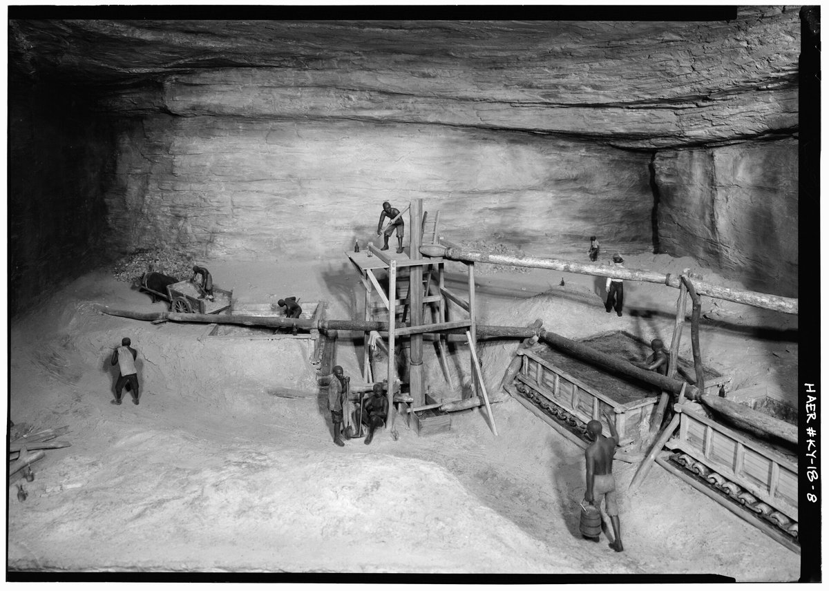
Museum model of a saltpeter leaching works with figures working at wooden vats, log pipes and a pump tower
A model of the Rotunda leaching works at Mammoth Cave, with dirt in wooden vats, hollow-log water pipes and a pump tower. Photo: Jet Lowe, HAER KY-18, Library of Congress, public domain. Wikimedia Commons

Arkansas saltpeter and the Confederacy

The Encyclopedia of Arkansas says early settlers already knew about saltpeter in Madison, Searcy, Independence, Marion and Newton counties. State geologist David Dale Owen’s survey, whose first report covered 1857 and 1858, described several “nitre caves” and analyzed their dirt.

The war made those caves valuable. Davis writes that in August 1861 Gen. Leonidas Polk told Jefferson Davis that two New Orleans chemists had found “any amount” of saltpeter in the White River caves. But the mines were badly worked, and the government was paying 25 cents a pound for saltpeter it could make itself for 10 cents. Polk urged the government to take the caves over and run them.

The Confederate Nitre and Mining Bureau ended up protecting the works, and its workers were exempt from military service. The encyclopedia says the problems were labor, security and transportation. After Pea Ridge in March 1862, Union troops could reach the Ozarks easily, many locals were Unionists, and saltpeter had to be hauled overland to the White River. The Bureau’s habit was to pull back when Federals came near and return a few weeks later. In July 1862 its superintendent, I. M. St. John, reported 17,000 pounds made in Arkansas before May 1 that couldn’t be counted “until the events of the war permit.”

By September 1863 the Bureau had left Arkansas. A January 1864 Confederate ordnance report in the Official Records says the north Arkansas niter caves “have all been abandoned from the approach of the enemy,” and that Maj. Isaac Read had gone to work caves in Texas. Guerrillas kept mining until the war ended, but the encyclopedia calls the Arkansas effort an ultimate failure.

Bean Cave, Marion County

Owen’s assistant, Edward T. Cox, described a bluff about 250 feet high on the immediate bank of the White River, in what was called the Horseshoe Bend, with “a number of rock-house caves” in it. The main one was “known generally as the Bean cave.” It was about 30 feet wide at the mouth, ran back a hundred feet or more, and averaged about eight feet high. Its walls were laminated, iron-red clay that crumbled to powder after it was dug down and left to dry. The dirt yielded about 3 to 6% saltpeter, and Owen noted that France’s artificial nitre beds averaged about 4%.

Cox found signs of much older work: “an old decayed leaching-hopper.” Early settlers told him a man named Bean once made nitre there, killed his partner in a quarrel and quit, “and to this day, the cave is known under the name of the ‘Bean cave.'” A second, wider cave sat about 100 yards away in the same bluff. Smith & Co. of Elgin had bought the land to make saltpeter, and an 1861 Nashville newspaper noted that small steamboats could reach the cave for much of the year.

Then came the raids:

  • April 19, 1862. Men under Capt. James T. Drummond of the 4th Iowa Cavalry crossed the White River in canoes, damaged a Confederate saltpeter works and burned buildings nearby. A Union howitzer broke up return fire from about 50 Confederates near Talbot’s (Talbert’s) Ferry, and Lt. William A. Heacock was mortally wounded. Davis identifies the works as Bean’s Cave.
  • Late November 1862. Col. Dudley Wickersham’s cavalry raid on Yellville disrupted the Bean Cave works, but according to the Encyclopedia of Arkansas they were soon running again.
  • December 1862. Capt. Milton Burch of the 14th Missouri State Militia Cavalry came through the woods with a local guide, Willoughby Hall, and reached the cave at noon while the Confederates were eating. “They mistook us for a company of their own men,” Burch reported, and they gave up without a shot. His men smashed an engine, six tanks and 26 large kettles with sledgehammers, burned five buildings, and destroyed $6,000 worth of saltpeter and 500 barrels of jerked beef.
  • April 1863. Davis says Union cavalry visited the works once more, and after that the cave “never achieved any importance.”

Some details are disputed. A local account by Thomas J. Estes, quoted by Davis, says men were killed in the December raid, which conflicts with Burch’s report. There’s also a legend about a buried keg of money, which is just folklore.

What I couldn’t verify: who owns Bean Cave today, whether anyone can visit it, and how the area has changed since Bull Shoals Lake was built. Davis’s 1967 article is the most recent detailed description I found, so treat anything newer you read online with caution.

Other documented Ozark niter caves

  • Cave Creek, Newton County. Owen describes several nitre caves here. One 200-bushel hopper from the main cave produced 1,000 pounds of saltpeter “in a very rude manner.” The same cave held bones, an ivory dirk and an infant’s skeleton in a willow basket, so it was an archeological site long before it was a mine.
  • Buffalo River. In January 1863 the 1st Iowa Cavalry surprised a works 14 miles from Kingston and destroyed 14 buildings, two steam engines and seven 800-pound kettles. A second works four miles downstream was destroyed too. The Park Service tells this story on its Bat Cave page, and the Encyclopedia of Arkansas says Boxley became a target because of nitre mined from bat guano on Cave Mountain.
  • Missouri Ozarks. The Journal of Spelean History says Henry Rowe Schoolcraft found saltpeter caves being worked on the Meramec and Gasconade in 1818. William H. Ashley ran a saltpeter plant at Ashley’s Cave in Texas County and supplied his powder factory at Potosi. Saltpeter Cave on the Meramec, now Meramec Caverns, was used by Southern sympathizers early in the Civil War, according to its marker.

What traces remain

In 1967 Davis wrote that at Bean Cave “only the excavations in the clay floor and walls” still showed what it had been used for. Two broken kettles were on display at a commercial cave in eastern Marion County, and a third had been used to scald hogs on a Baxter County farm. Don’t assume they’re still in those places.

Better-studied caves show what else to look for. A National Register nomination for a Kentucky saltpeter cave lists spoil piles of leached dirt stacked to the ceiling, dried-dirt “casts” of vats that still show board impressions, pick marks in dirt faces, and floors dug down several feet. It also notes that visitors did the most damage, taking vat boards as souvenirs or firewood.

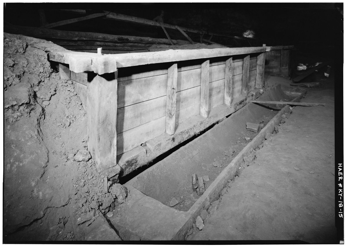
Close view of a wooden saltpeter leaching vat with plank sides and a drainage trough along its base
A leaching vat and drainage trough at Mammoth Cave. In other caves, the only trace of a vat may be a dirt outline. Photo: Jet Lowe, HAER KY-18, Library of Congress, public domain. Wikimedia Commons

Mining didn’t erase the older history underneath. The Arkansas Archeological Survey excavated a Saltpeter Cave in Newton County in 1969 and 1970. Even though it had been mined during the Civil War, the Survey found nearly 14 feet of deposits covering at least 9,000 years. The site had also been looted, including a burial removed in the early 1960s.

Visiting today: closures, bats, permission, safety

Many caves are closed. Every cave and mine in the Ozark-St. Francis National Forest except Blanchard Springs Caverns is closed by order of the regional forester because of white-nose syndrome. At Buffalo National River, all caves are closed to recreational caving except Eden Falls Cave and Natural Bridge in Lost Valley and Panther Cave and Indian Rockhouse at Buffalo Point. Back O’Beyond and Silver Hill caves are open for guided tours only. In Missouri, caves on Conservation Department land have been closed to the public since 2010, apart from guided programs.

White-nose syndrome is here. Arkansas first confirmed it in 2012, in northern long-eared bats from a Marion County cave. By 2019 it had reached 15 counties, and tricolored bats dropped about 66% from 2015 to 2017. Spores ride on clothes, boots and gear, so decontaminate everything before and after a cave trip following the national protocol, and stay away from hibernating bats.

Get permission. The Arkansas Game and Fish Commission has encouraged landowners to keep the public out of their caves. Both the Encyclopedia of Arkansas and the Missouri Department of Conservation say to check with the landowner or manager first. If you’re not sure whose land it is, see How to Find Your Property Lines.

Basic safety, from the U.S. Forest Service: never cave alone (go with four to eight people), and tell someone who isn’t going when you’ll be back. Wear a helmet with a light, boots and gloves, and carry three light sources per person. Stay out when rain is forecast, since caves can flood suddenly, and don’t drink cave water.

Safety: Old mined caves have loose dirt banks, rotten timbers, drop-offs and snakes near the entrance (see Venomous Snakes of Arkansas). Keep fires outside and away from the entrance, because Arkansas law bans burning anything in a cave or sinkhole that gives off smoke harmful to cave life. For fire basics, see How to Start (and Put Out) a Campfire Safely.

The law: look, photograph, leave it

Arkansas. Under the Arkansas Cave Resources Protection Act (Act 523 of 1989, Ark. Code § 15-20-603), it’s a Class A misdemeanor to do any of these on purpose or recklessly without the owner’s express permission:

  • Deface cave surfaces or formations.
  • Remove protected material.
  • Damage a cave gate.
  • “Excavate, deface, or disrupt the integrity of any identifiable archeological or paleontological site” in a cave.

The act counts anything 50 years old or older as an archaeological site, which covers Civil War vats and kettles. Walking into an unposted cave isn’t a violation by itself.

Federal land. On national park and national forest land, the Archaeological Resources Protection Act (ARPA) covers remains of human activity at least 100 years old, including tools and structures. The Park Service says excavating or trafficking can mean up to two years in prison and a $20,000 fine, and that ARPA cases have been prosecuted at Buffalo National River.

If you find an old kettle, vat board or tool, take a picture, leave it where it is, and tell the landowner or land manager.

If you want to see one

The Park Service’s Rotunda stop at Mammoth Cave National Park in Kentucky shows original vats and the remains of a pump tower just inside the Historic Entrance. Meramec Caverns near Stanton, Missouri, has recreated V-shaped hoppers inside the cave and a Civil War marker at the entrance. For more Ozark history, see Ozark Springhouses and Arkansas and Ozarks History Worth Knowing.

Related on djgaston.com

Sources

  • Lee Carson Davis, “Bean Cave, Marion County, Arkansas,” White River Valley Historical Quarterly 2 (Spring 1967), via Springfield-Greene County Library: sgcld.thelibrary.org
  • David Dale Owen, First Report of a Geological Reconnoissance of the Northern Counties of Arkansas, Made During the Years 1857 and 1858 (1858), including E. T. Cox’s Marion County report: archive.org
  • George W. Rains, Notes on Making Saltpetre from the Earth of the Caves (New Orleans, 1861): archive.org
  • Encyclopedia of Arkansas, “Saltpeter Mining”: encyclopediaofarkansas.net
  • Encyclopedia of Arkansas, “Expedition from Ozark, Missouri, to Marion County (December 9–15, 1862)”: encyclopediaofarkansas.net
  • Encyclopedia of Arkansas, “Yellville Expedition (November 25–29, 1862)”: encyclopediaofarkansas.net
  • Encyclopedia of Arkansas, “Skirmish at Talbot’s Ferry”: encyclopediaofarkansas.net
  • Encyclopedia of Arkansas, “Boxley (Newton County)” and “White Nose Syndrome”: Boxley; White Nose Syndrome
  • National Park Service, Buffalo National River, “Union Raid on Saltpeter Works at Bat Cave” and “Cave / Karst Systems”: nps.gov/buff; cave closures
  • Official Records, Series I, Vol. 22, Part 2 (Huger report, Trans-Mississippi Ordnance, January 1864), transcription: civilwar.com
  • Nashville Union and American, August 17, 1861 (“Gunpowder for the South”), Chronicling America, transcribed at Ozarks’ History: ozarkshistory.blogspot.com
  • National Park Service, Mammoth Cave, “From Dirt to Gunpowder” and “Saltpetre Vats (Rotunda)”: nps.gov; Rotunda
  • Library of Congress, HAER KY-18, “Mammoth Cave Saltpeter Works”: loc.gov/item/ky0272
  • Dwight Weaver, “Early Gunpowder Making and Saltpetre Mining in Missouri Caves,” Journal of Spelean History, hosted by the National Speleological Society: caves.org
  • Historical Marker Database, “Saltpeter Cave” (Missouri’s Civil War Heritage Foundation marker, Meramec Caverns): hmdb.org
  • National Register of Historic Places nomination, Saltpeter Cave (15Cr99), Carter County, Ky.: npgallery.nps.gov
  • Arkansas Archeological Survey, “Saltpeter Cave” and “Dating Saltpeter Cave”: archeology.uark.edu
  • U.S. Forest Service, Ozark-St. Francis NF “Climbing and Caving” and “Cave Safety”: fs.usda.gov; cave safety
  • Missouri Department of Conservation, “Missouri Caves” (Missouri Conservationist, March 2023): mdc.mo.gov
  • Arkansas Cave Resources Protection Act, Act 523 of 1989 (Arkansas Archeological Survey copy) and Ark. Code § 15-20-603: Act 523; § 15-20-603
  • National Park Service, “Archaeological Resources Protection Act of 1979,” and 16 U.S.C. § 470bb: nps.gov; law.cornell.edu

Follow Danny on X: @djgaston19

Ozark Springhouses: How Families Kept Food Cold Before Refrigerators

Before there was a refrigerator in every kitchen, a lot of Ozark families had the next best thing: a cold spring coming out of the hillside and a little stone house built right over it.

Quick answer A springhouse is a small building, usually stone, built over or just below a spring. Ozark spring water comes out of the ground at a steady temperature in the mid-to-upper 50s °F all year, so a springhouse stayed cool in summer and above freezing in winter. Families set crocks of milk and butter in the running water and kept meat, eggs and produce on the shelves. It worked well for its time, but 55–58 °F is well above today’s 40 °F food-safety line, and untreated spring water isn’t safe to drink without testing.
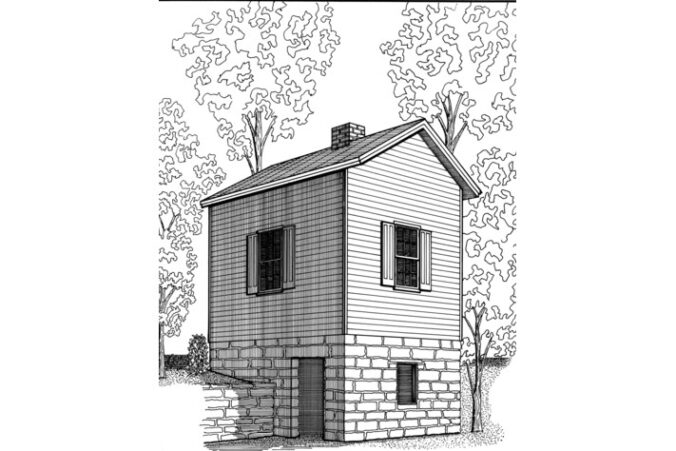
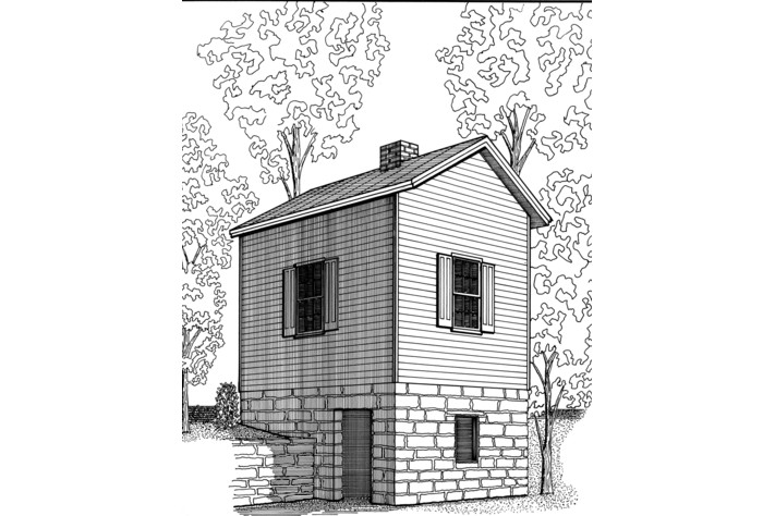
Drawing of Dr. John C. Carter's two-story office built on a stone springhouse foundation
Dr. John C. Carter’s office, built over a spring on the Middle Fork of the White River and now at the Shiloh Museum in Springdale. Drawing: Historic American Buildings Survey (HABS AR-45), Library of Congress, public domain. Wikimedia Commons

Why the Ozarks have so many springs

The Ozark Plateau sits mostly on limestone and dolomite. Rain soaks through the leaf litter, picks up a little acid, and slowly dissolves cracks and channels in that rock. Over a very long time that makes caves, sinkholes, losing streams and springs. When the water hits a layer it can’t pass through, it moves sideways until it finds a way out of a hillside or a creek bank. That’s a spring.

The Missouri Department of Conservation puts it simply: spring water is cold, about 56 °F, because that’s the steady temperature of the ground deep below the surface. A 1977 Bittersweet article, written by Lebanon, Missouri, high school students who interviewed Ozark old-timers, puts their springs at “about 58 degrees” year-round. Either way, it’s the key to the whole idea: the water coming out of the hill doesn’t care if it’s July or January.

What a springhouse was (and how it worked)

A springhouse did two jobs at once. It covered the spring so leaves, dirt, livestock and wild animals stayed out of the family’s drinking water, and it used that cold water as a refrigerator.

  • Location. Springs usually come out at the base of a hill, so the springhouse was often dug partly into the bank. Sometimes it sat right over the spring; sometimes it sat a little downhill and the water was piped or channeled in.
  • The pool and trough. Builders often dug out the spring and lined it with rock, or built a trough in the floor, so cold water ran through a shallow channel and then back outside to the branch or creek.
  • Crocks in the water. Milk, cream, butter and cheese went into crocks or jugs set down in the running water. Fruits and vegetables could go in nets or gunny sacks in the water. Meat might hang inside after butchering until it was cooked or smoked.
  • Thick stone walls. The earliest Ozark springhouses were often log on sandstone footings, and the logs rotted. Later ones were built with thick rock walls. Stone holds the cool, and a rock building is more likely to survive a flood.

The constant flow also helped in winter. The Bittersweet interviews note that the spring itself hardly ever froze; when ice formed, it was on the water that had already run out into the trough. Break it, and warmer water was still moving underneath. Even the air inside stayed cooler than outdoors in summer and warmer in winter.

It wasn’t all easy. If the spring was downhill from the house, somebody, often the women or kids, made the trip before every meal. One woman interviewed by Bittersweet remembered carrying two buckets up a steep hill: “time you would get up that steep hill with two buckets of water, you’d know you’d been somewhere.” And after a big rain, Ozark springs could run muddy for a day or two and even flood the springhouse until it cleared.

Springhouses weren’t just an Ozark thing. Pennsylvania farms used them for generations, and some had the outlet run to a pond where fish were kept alive until supper. At Hopewell Furnace National Historic Site in Pennsylvania, the National Park Service still shows a springhouse built about 1806–1807, with its water holding at 56 °F.

As iceboxes and then electric refrigerators reached the countryside, the springhouse faded out. A lot of the “well houses” that came later, sheds over a pump and pressure tank, borrowed the same trick: cool groundwater keeps the little building cool.

Dr. John C. Carter’s office over a spring

One of the best surviving examples in northwest Arkansas is a little two-story building at the Shiloh Museum of Ozark History in Springdale: Dr. John C. Carter’s office.

According to the Washington County Historical Society, Dr. John Calhoun Carter was probably born around 1828 in Tennessee, came to Washington County in 1851, and, like a lot of men from the area, went to California for the Gold Rush. The Historic American Buildings Survey (HABS) write-up says he went in 1854, came back in 1860, and was apprenticing as a physician. He didn’t enlist in the Civil War; the Historical Society says his neighbors persuaded him he was needed as a doctor at home, and that, like many people in those hills, he was harassed by bushwhackers and is said to have come close to being hanged.

After the war he bought land in the Middle Fork valley of the White River, south of Fayetteville. HABS records that he bought the property in 1871 and probably hired George W. Vanhoose (Van Hoose) to build the office and springhouse, sometime between 1872 and 1883; tax records show big jumps in value in those years. The building is a rural Greek Revival style, set beside the Middle Fork on the road from Sulphur City to Hazel Valley, and its stone foundation enclosed a small spring that drained into the White River. Upstairs was the doctor’s office. Downstairs, the Shiloh Museum notes, the sandstone foundation formed a springhouse for keeping food.

Across the road was Carter’s store, a gathering point for settlers in the valley. A post office named Carter’s Store opened there on July 1, 1875; it was later renamed Carter Store, then Carter, and finally Hicks before it closed in 1953.

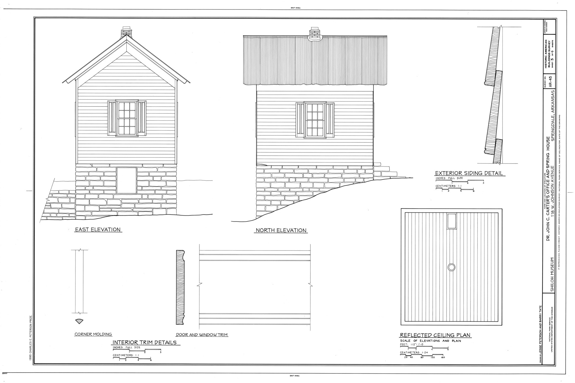
HABS measured drawing showing the east and north elevations of Dr. Carter's office on its stone springhouse foundation
Measured drawings by University of Arkansas architecture students show the wood-frame office sitting on a stone springhouse dug into the slope. HABS AR-45 (drawn 1995 by Jesse Peterson and Barry Tate), Library of Congress, public domain. Wikimedia Commons

The Sulphur City health-resort dream

Carter’s spring wasn’t the only one nearby that people had big plans for. After Eureka Springs boomed as a “healing waters” resort, promoters in the Mankins community nearby renamed it Sulphur Springs, then Sulphur City when they found the first name was already taken. In the early 1880s they put up a springhouse and guest cottages, laid out 24 town blocks, and planned a park and hotel. Promoters claimed the sulphur water helped gout, indigestion, cancer and rheumatism, and the Shiloh Museum says Dr. Carter prepared to give bloodletting and other treatments at his nearby office.

It never took off. Patients would have had to ride ten or more miles from Fayetteville or Elkins over rough roads, and the spring didn’t produce much water. George Van Hoose, writing as the local correspondent for a Fayetteville paper, summed up the hotel: “The timbers of the hotel remain growing in the forest.”

Moved to Springdale

The 1870 census listed Dr. Carter’s occupation as “merchant,” and he ran the store until his death in 1886. HABS found no record of him using the office after 1883. After that it fell out of use; a local woman born in 1911 remembered it being used only for storage, apart from a few weeks in 1935 when she put up out-of-town guests in it as a spare bedroom.

The Shiloh Museum acquired the building in 1986 and moved it to the museum grounds in Springdale in 1987. The office was set back on its original foundation stones, with the springhouse slightly reconfigured to fit the new site. In 1995, University of Arkansas School of Architecture students measured and drew it for HABS, the federal survey whose drawings are kept at the Library of Congress. It’s one of several historic buildings on the museum’s campus at 118 W. Johnson Avenue, and museum admission is free.

Other old-time ways the Ozarks kept things cool

  • The spring itself. Before (or instead of) a building, people deepened the spring and lined it with flat sandstone so they could dip a bucket without stirring up mud, and set jugs right in it.
  • Caves. Caves hold close to the area’s ground temperature too, and the Bittersweet interviews list “a cave nearby” right alongside springs as a way farmers kept food.
  • Wells and cisterns. Lowering a pail of milk or butter down into a well was common where there was no spring.
  • Root cellars. Dug into the ground for potatoes, apples, cabbage and other keepers through the winter.
  • Smoking, salting and canning. Meat that couldn’t stay cool for long was cured or smoked, and the garden was canned.

Could you use a springhouse today?

Yes, for some things, but not as a replacement for your refrigerator.

Food safety: 55 °F is not 40 °F

The USDA says bacteria grow fastest between 40 °F and 140 °F (the “Danger Zone”), with some doubling in as little as 20 minutes. Refrigerators should be at 40 °F or below. A springhouse running in the mid-50s is a lot cooler than a summer kitchen, but it’s still in that zone. Our grandparents’ milk was used within a day or two and they knew the risk; you don’t have to take it.

What a springhouse, spring-fed cellar or cool stone room is good for:

  • Winter squash and pumpkins: about 50–55 °F and fairly dry (University of Missouri Extension). Cure them first, except acorn types.
  • Sweet potatoes: about 55–60 °F and humid (Iowa State and UMass Extension). Below 50–55 °F they get chilling injury.
  • Potatoes: they like it colder, about 38–45 °F. In a 55 °F room expect them to sprout in a couple of months.
  • Canned goods, drinks, a watermelon on a hot day, and keeping anything out of the heat. And a cool spot to work in July.

Don’t store apples or other ripening fruit next to potatoes or squash; ripening fruit gives off ethylene gas that makes potatoes sprout and shortens squash storage. Keep an appliance thermometer in there so you know what it’s really doing through the year.

Drinking water: test it

Clear, cold spring water looks pure, but springs are fed by shallow groundwater, and in karst country like the Ozarks water can travel fast through the rock with little filtering. The Missouri Department of Conservation says to treat spring water like any other creek water. Penn State Extension recommends:

  1. Test before you use a spring for drinking, at a state-certified lab, and test for coliform bacteria at least once a year after that.
  2. Build or repair a watertight spring box with a tight-fitting lid, an outlet pipe, an overflow and a drain, so insects, animals and surface water can’t get in.
  3. Divert surface runoff away, fence livestock out of the spring’s drainage area, and keep other activities at least 100 feet from the box.
  4. Expect to need treatment. Most springs need some, and if bacteria keep showing up, plan on continuous disinfection such as UV.

In Arkansas, your county health unit or the Arkansas Department of Health can point you to water testing. Also check the water after big rains, when Ozark springs are most likely to run cloudy.

Safety: Old springhouses can have loose stonework, rotten floors and snakes. Look before you reach into dark corners or under rocks, and be careful around old cisterns and dug wells, which can be deep and hidden by boards or brush.

If you want to see one

The Shiloh Museum of Ozark History at 118 W. Johnson Avenue in Springdale has Dr. Carter’s office on its grounds along with a log cabin, a general store, a barn and other buildings moved in from around the region. The museum is open Monday through Saturday, 10 a.m. to 5 p.m., with free admission (check its Plan Your Visit page before you go). Down in the Middle Fork valley, the Shiloh Museum says a tumbled stone wall and the sulphur smell still mark the old Sulphur City spring along County Road 57, across from the Sulphur City Baptist Church.

Related on djgaston.com

Follow Danny on X: @djgaston19

Sources